
MME Updates Digital Aerial Photos Database for Al Shamal, Ruwais, Abu Dhalouf
البلدية والبيئة تحدث قاعدة بيانات الصور الجوية الرقمية لـ الشمال والرويس وأبوظلوف
QNA
Doha: The Center for Geographic Information Systems (CGIS) of the Ministry of Municipality and Environment (MME) carried out aerial photography of Al Shamal, Ruwais, and Abu Dhalouf, using drones, as part of its plan to update the digital aerial imagery database for geographic information systems in the country.
The photography was done with a high resolution of 5 cm (that is, each point or pixel on the map represents five square centimeters in reality).
The CGIS, through its adoption of this system, seeks to benefit from modern technologies and integration with the rest of the means of updating data from satellite images and images captured by conventional aviation and field survey, to update the databases of digital geographic information systems of all kinds and make them available to ministries and government institutions through the national network of geographic information systems.
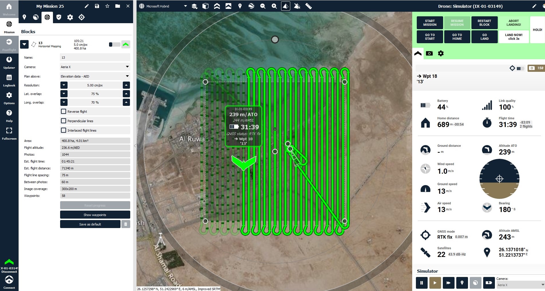
The drones can fly at low altitudes between 240 and 500 meters for up to an hour.
The CGIS uses this type of drones to photograph areas with relatively limited areas to update and according to the need of ministries and state institutions for such images. The center owns a fleet of drones consisting of seven types of fixed-wing or propeller aircraft.
All stages of the work are carried out, starting from the development of the flight plan, photography, and filming, followed by processing aerial images and converting them into geographic information systems data, by a specialized team of the center’s staff.
Al Khor and parts of Doha will be photographed in the next stage.
قنا
الدوحة: قام مركز نظم المعلومات الجغرافية التابع لوزارة البلدية والبيئة بأعمال التصوير الجوي لمدينة الشمال والرويس وأبوظلوف باستخدام طائرات بدون طيار، وذلك ضمن خطته لتحديث قاعدة بيانات الصور الجوية الرقمية لنظم المعلومات الجغرافية في الدولة.
وقد تم التصوير بدقة عالية تبلغ 5 سنتمترات (أي كل نقطة او بيكسل على الخارطة تمثل 5 سم مربع على الواقع)، ويسعى مركز نظم المعلومات الجغرافية من خلال تبنيه لهذه المنظومة إلى الاستفادة من التقنيات الحديثة والتكامل مع باقي وسائل تحديث البيانات من صور أقمار اصطناعية وصور ملتقطة بواسطة الطيران التقليدي والمسح الحقلي، من أجل تحديث قواعد بيانات نظم المعلومات الجغرافية الرقمية بأنواعها وجعلها متاحة للوزارات والمؤسسات الحكومية من خلال الشبكة الوطنية لنظم المعلومات الجغرافية جاعلا نصب عينيه عملية التطوير والتحديث.
وتتميز الطائرات المسيرة بقدرتها على الطيران على ارتفاعات منخفضة ما بين 240 و 500 متر، ولمدة تصل إلى ساعة كاملة.
ويستخدم مركز نظم المعلومات الجغرافية هذا النوع من الطائرات في تصوير مناطق ذات مساحات محدودة نسبياً بغرض التحديث وبحسب حاجة وزارات ومؤسسات الدولة للبيانات الناتجة عن التصوير، حيث يملك المركز أسطولا من الطائرات من دون طيار مكونا من سبع طائرات بنوعيها ذات الجناح الثابت أو تلك التي تعمل بالمراوح.
ويتم تنفيذ جميع مراحل العمل ابتداء من وضع خطة الطيران والتصوير ثم التصوير، تليها معالجة الصور الجوية وتحويلها إلى بيانات نظم معلومات جغرافية من خلال فريق متخصص من كوادر المركز.
تجدر الإشارة الى أنه سيتم تصوير كل من مدينة الخور وأجزاء من مدينة الدوحة في المرحلة التالية.


