Ashghal wins GIS Excellence Award
«أشغال» تحصد جائزة التميز في نظم المعلومات الجغرافية
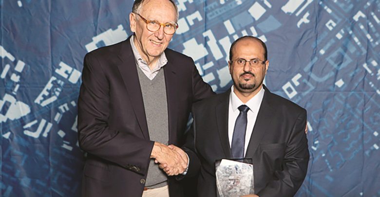
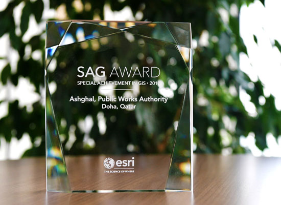
The Public Works Authority’s (Ashghal) Information Systems Department and Engineering Services Department have won the GIS Excellence Award for the use of GIS technology in Moazanah Programme, it was announced on Monday.
The award was presented on the sidelines of the Esri Global User Conference 2019, held in San Diego from July 8 to 12.
On behalf of Ashghal, head of Development Section in the Information Systems Department Saad Mohamed al-Jermozi received the award. He pointed out that Ashghal is one of the first GIS users in Qatar.
Moazanah is aimed at simplifying the process of preparing budgets for major state projects including their review and approval. Among the overall objectives of the programme is to ensure that financing of projects goes smoothly with full transparency for all governmental agencies.
Ashghal implemented Moazanah Programme in order to help government entities including Ashghal departments apply for projects that they want to be implemented through Ashghal. These include the construction and development of schools, hospitals, health centres, service buildings and other infrastructure development projects.
New additions and features that help users request projects, take approvals and follow up their implementation have been added to Moazanah Programme. The applicants can also get integrated reports on projects in a speedy and much easier way.
Through the programme, applications for preparing the budget for 522 projects have been submitted for next year. Compared to the previous year, time to submit applications for budget went down by 70%. This year, application for preparing budget was done within three working weeks compared to nearly three months in the past.
Ashghal re-developed Moazanah Programme to simplify the process of submitting budget project requests enabling all ministries and government agencies to submit applications and review them through this system.
The Esri International Conference brings together thousands of GIS participants and specialists from 130 countries. It provides them with an ideal opportunity to share experiences, showcase different achievements and strategies in the fields of GIS. Esri International Conference is one of the spectacular global events in this field.
/tab]
حصلت هيئة الأشغال العامة «أشغال» -ممثلة بإدارة نظم المعلومات وإدارة الخدمات الهندسية- على جائزة التميز بنظم المعلومات الجغرافية لاستخدام تقنية نظم المعلومات الجغرافية في برنامج موازنة. جاء ذلك على هامش المؤتمر العالمي لمستخدمي «إزري 2019»، والذي أقيم بمدينة سان دييجو الأميركية خلال الفترة من 8 -12 يوليو الحالي.
تسلم الجائزة السيد سعد محمد الجرموزي رئيس قسم التطوير بإدارة نظم المعلومات في «أشغال»، وأكد أن الهيئة من أوائل الجهات التي تستخدم أنظمة المعلومات الجغرافية في قطر.
وقد جرى تنفيذ برنامج موازنة لتمكين الجهات الحكومية -التي تتضمن الإدارات الداخلية في «أشغال»- من تقديم طلب للمشاريع التي ترغب في تنفيذها من خلال الهيئة، مثل: المدارس، والمستشفيات، والمراكز الصحية، والمباني الخدمية، ومشاريع البنية التحتية، وغيرها.
ويحتوي برنامج «موازنة» على إضافات ومميزات جديده تمكن مستخدميه من طلب المشاريع وأخذ الموافقات ومتابعة تنفيذها، كما يمكنهم الحصول على تقارير متكاملة عن المشاريع في وقت قياسي، وبشكل أكثر سهولة، بالإضافة إلى أنه يتكامل مع برنامج أوراكل بريمافيرا «P6»، ويستخدم نظم المعلومات الجغرافية بشكل متكامل، كما يتكامل أيضاً مع نظام إدارة الوثائق المركزي «CDMS»، ونظام تخطيط الموارد المؤسسية «ERP».
وقد تم من خلال البرنامج طلب عدد 522 مشروعاً لموازنة النسخة الأولى من مشاريع العام المقبل 2020، وفي وقت يقل بنسبة 70 % عن الأعوام الماضية، وتم ذلك خلال 3 أسابيع، وخلال أوقات العمل الرسمي فقط، مقارنة مع ما يقرب من 3 أشهر في السابق.
وكانت الهيئة قد قامت بإعادة تطوير نظام «موازنة» بهدف تسهيل عملية تقديم طلبات المشاريع لموازنة الدولة، ومن ثم مراجعتها واعتمادها في وقت قياسي، بالإضافة إلى متابعة عمليات التمويل للمشاريع بشفافية لجميع الوزارات والهيئات الحكومية، وتمكينها من المتابعة من خلال هذا النظام.
الجدير بالذكر أن «مؤتمر إزري الدولي» يجمع الآلاف من المشاركين والمختصين في مجال نظم المعلومات الجغرافية من 130 دولة، كما أنه يشكل فرصة مثالية لتبادل الخبرات وعرض الإنجازات والاستراتيجيات المختلفة في مجال نظم المعلومات الجغرافية، وحدثاً عالمياً مهماً في هذا المجال.


